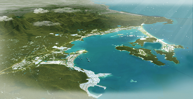
- Van Phong Economic Zone is located in the northern part of Khanh Hoa province, about 30 km north of Nha Trang city; it was established by the Prime Minister under Decision No. 92/2006/QD-TTg dated April 25, 2006, with a total area of approximately 150,000 ha (70,000 ha land and 80,000 ha water) within Van Ninh district and Ninh Hoa town, Khanh Hoa province, belonging to the South Central Coast region of Vietnam.
* Location:
Van Phong Economic Zone is located in the northern part of Khanh Hoa province:
- Distance to Ho Chi Minh City: approximately 500 km.
- Distance to Hanoi: approximately 1,200 km.
- Distance to Nha Trang City (center of Khanh Hoa province) to the north: about 30 km.
- Distance to Cam Ranh International Airport: about 65 km south of the Economic Zone.
- Distance to Tuy Hoa Airport - Phu Yen province: about 40 km north of the Economic Zone.
* Infrastructure:
- Road: National Highway 1, National Highway 26B, Provincial Road 1A, Provincial Road 1B, road from National Highway 1A to Ninh Hai connecting the functional zones in South Van Phong area, the main axis road from National Highway 1A (Co Ma Pass) to Van Phong international transshipment port.
- Expressways: two expressways are under construction to connect the economic zone with the Central Highlands and the South Central Coast provinces, specifically:
+ North-South Expressway;
+ Khanh Hoa – Dak Lak Expressway
- Seaway: Nam Van Phong general port (70,000 DWT) adjacent to Ninh Thuy Industrial Park; Bac Van Phong general port (50,000 DWT) at Dam Mon; Hon Khoi port (3,000 DWT) and other specialized ports...
- Air transport: about 65 km to Cam Ranh International Airport to the south of the Economic Zone, about 40 km to Tuy Hoa Airport – Phu Yen province to the north of the Economic Zone.
- Railway: the North-South railway runs along the Economic Zone.
- Water supply: water supply system from Da Ban reservoir (75 million m3); Tien Du reservoir (9 million m3); Dong Dien reservoir (capacity 100 million m3); Hoa Son reservoir (19 million m3).
- Power supply: national grid via Tuy Hoa - Nha Trang 220KV station; 110KV substation in Ninh Thuy Industrial Park; 35KV low-voltage network installed up to the international transshipment port area.
- General hospital, schools, tourist areas, etc. have been developed synchronously to meet the living needs of residents and workers in the economic zone.
- Communication systems, human resources, and resettlement areas are basically ready to meet investors' requirements.
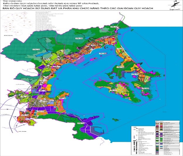
MASTER PLAN FOR THE CONSTRUCTION OF VAN PHONG ECONOMIC ZONE, KHANH HOA PROVINCE TO 2040, VISION TO 2050
On March 27, 2023, the Prime Minister issued Decision No. 298/QD-TTg approving the adjustment of the master plan for Van Phong Economic Zone, Khanh Hoa province to 2040 with a vision to 2050. The Van Phong Economic Zone is planned with a vision to 2050 and is characterized as:
- A multi-sector, multi-field comprehensive economic zone that plays a leading role in attracting investment and driving economic development for neighboring regions and the country. The marine economy is the foundation with an international container transshipment port and logistic services; urban areas, services, tourism and industry play important roles, combined with the development of other economic sectors.
- A center for high-end integrated tourism and entertainment services with unique, differentiated, modern and high-quality tourism products, branded and internationally competitive.
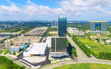
- An area for developing smart, sustainable urban areas with modern and synchronous social infrastructure.
- Having an important position in national security and defense.
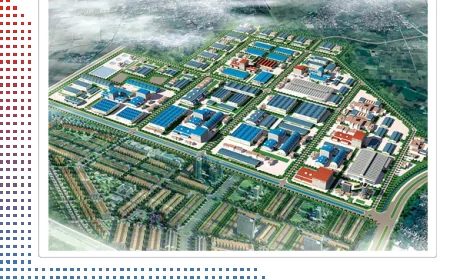
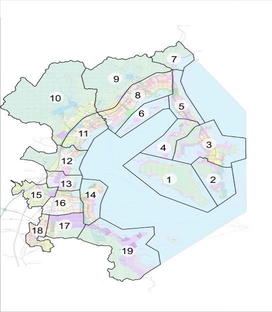
The Van Phong Economic Zone is divided into 19 subzones, including: Subzone 01 - Hon Lon Island eco-tourism area; Subzone 02 - Khai Luong Mountain tourism area; Subzone 03 - Dam Mon seaport center, urban area, high-end tourism; Subzone 04 - Vinh Yen - Mui Da Son urban and tourism area; Subzone 05 - Tuan Le - Hon Ngang urban and tourism service area; Subzone 06 - Diep Son Island tourist area; Subzone 07 - Dai Lanh eco-urban area; Subzone 08 - Co Ma - Tu Bong urban tourism area; Subzone 09 - Tay Tu Bong mountain ecological area; Subzone 10 - Tay Van Gia mountain ecological area; Subzone 11 - Van Gia urban area and surrounding region; Subzone 12 - South Van Gia urban area; Subzone 13 - Van Hung industrial and service area; Subzone 14 - Ninh Hai multifunctional eco-urban area; Subzone 15 - Tay Ninh An urban-industrial service area; Subzone 16 - Northeast Ninh Hoa urban and residential service area; Subzone 17 - North Hon Heo urban and industrial area; Subzone 18 - Ninh Hoa central service urban area; Subzone 19 - Nam Van Phong industrial and seaport functional area.
- SOUTH VAN PHONG AREA
South Van Phong Area (the eastern part of Ninh Hoa town) is oriented to plan for a container transshipment port, general-purpose ports, industrial complexes, warehouses taking advantage of deep-water port benefits, urban areas and tourism service areas. These are interspersed with mangrove ecological spaces, coastal hills, along Provincial Road 652D as well as east of the North-South national railway.
Some large-scale industrial projects have been and are being implemented in this area such as: Hyundai-Vietnam shipbuilding yard (800,000 DWT; USD 475 million), Van Phong fuel depot (capacity 500,000 m3; USD 125 million), Nam Van Phong general port (70,000 DWT; USD 40 million), Van Phong BOT thermal power plant 1 (1,320 MW; USD 2.5 billion)…
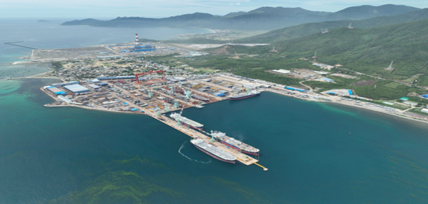
Hyundai – Vietnam Shipyard
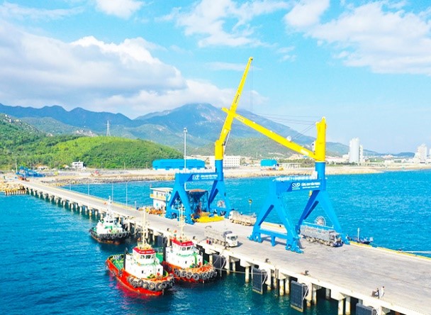
Nam Van Phong general port
- NORTH VAN PHONG AREA
North Van Phong Area (Van Ninh district) is oriented to develop high-end tourism on Hon Lon island and Hon Gom peninsula, an international transshipment port, international tourist port, port logistics facilities, industry at Dam Mon area, urban and tourism zones, green spaces, water surfaces and hilly areas.
Some ecological tourism projects have been and are being implemented: Bai Cat Tham tourism area (area: 160 ha water, 295 ha land, total investment: VND 25,253 billion); Bai Ong Hao tourism area (area: 5.2 ha water, 5.75 ha land; total investment: VND 53 billion); Bai Ong Nghi tourism area (area: 6 ha water, 15 ha land; total investment: VND 149.5 billion); Bac Van Phong general port (50,000 DWT; USD 20 million).
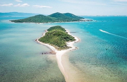
Diep Son Island
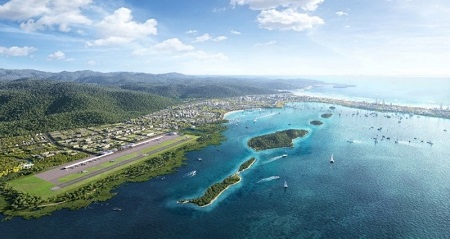
Planned airport layout
II. INVESTMENT PROJECTS:
1. List of projects calling for non-state capital investment:
|
No. |
Project Name |
Investment Location |
Area |
Total Investment |
Land Lease Price |
Objectives |
|
1 |
Secondary project into Ninh Thuy Industrial Park |
Ninh Thuy Ward, Ninh Hoa Town |
207.9 ha |
Depends on project scale |
Land lease price with infrastructure as of June 2063, as agreed between investor and infrastructure owner |
Focus on attracting projects in the following groups: |
* For other areas, the Management Board is currently organizing the preparation of sub-zone planning of functional areas in Van Phong Economic Zone, therefore the list of non-state investment projects is expected to be approved and announced by the end of 2023.
III. INDUSTRIAL PARKS
According to Decision No. 318/QD-TTg dated March 29, 2023 of the Prime Minister approving Khanh Hoa province's planning for the period 2021-2030 with a vision to 2050, Khanh Hoa focuses on developing the following industrial parks:
PLAN FOR THE DEVELOPMENT OF INDUSTRIAL PARKS IN KHANH HOA PROVINCE FOR 2021 – 2030, VISION TO 2050
|
No. |
Industrial Park Name |
Location |
Planned Area |
Area allocated by 2030 |
Area expected to be allocated after 2030 (ha) |